My last post about red wolves ended on the topic of re-introduction into the wild. In 1987, four breeding pairs were released at the Alligator River National Wildlife Refuge (ARNWR), located in eastern North Carolina. This was a monumental step in the recovery program for the species; if these 8 individuals were successful at holding territories and reproducing, there was a good chance that a wild population of red wolves could be established once again. To improve the odds of their success, the United States Fish and Wildlife Service (USFWS) set up a 5 County Recovery Area that they could monitor closely while this new wild population grew and established itself.
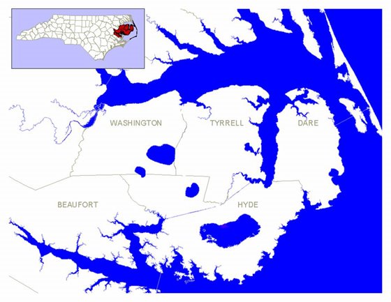
This area was based around ARNWR and includes the counties of Dare, Hyde, Tyrell, Washington and Beaufort. The original concept of the re-introduction was to have the wolves first establish themselves in the county furthest east (Dare County), and move westward into other counties as their population grew. This would allow the USFWS to monitor the red wolves more closely as they moved, as opposed to having them scattered throughout all 5 counties at once. It also made it easier to deal with coyotes in these areas (usually by removal or spay/neuter) as the red wolves pushed over, since interbreeding of the two species would be detrimental to the recovery program.

Adaptive Management Zones map courtesy of U.S. Fish and Wildlife Service Red Wolf Recovery Program.